■While scientists around the world are confined to their homes during the COVID-19 pandemic, Earth observing satellites continue to orbit and send back images that reveal connections between the pandemic and the environment. “Satellites collect data all the time and don’t require us to go out anywhere,” Hannah Kerner, an assistant research professor at the University of Maryland in College Park, said.
Kerner is among eight researchers recently awarded a rapid-turnaround project grant, which supports investigators as they explore how COVID-19 lockdown measures are impacting the environment and how the environment can affect how the virus is spread.
The newest group of projects includes six that are looking to satellite images to help reveal how COVID-19 lockdown measures are impacting food security, fire ecology, urban surface heat, clouds and warming, air pollution and precipitation, and water quality and aquatic ecosystems. Two projects are exploring how the environment could be impacting how the virus is spread by monitoring dust and weather.
NASA’s Earth Science Division manages these projects that find new ways to use Earth observing data to better understand regional-to-global environmental, economic, and societal impacts of the COVID-19 pandemic.
Counting crops during COVID
This year was looking to be a relatively normal year for crops until the pandemic and associated lockdown policies happened. Reduced air and ground travel caused the demand for ethanol to plummet, which caused corn prices to decline. Lockdown policies also made it harder for officials from the U.S. Department of Agriculture (USDA) to travel to farms and collect information about crop planting, progress, and conditions.
The subsequent lack of public information about crops caused uncertainty and volatility in agricultural markets and prices as growing seasons progressed. “Markets want to know how much of a specific kind of crop to expect,” Kerner said.
Kerner and her team are looking to satellite data from NASA’s and the U.S. Geological Survey’s Landsat, ESA’s (the European Space Agency) Copernicus Sentinel-2, NASA’s Moderate Resolution Imaging Spectroradiometer (MODIS) aboard the Terra and Aqua satellites, and Planet’s satellites to help supplement USDA’s information.
“We’re using satellite data and machine learning to map where and which crops are growing,” Kerner said. Specifically, they’re monitoring key commodity crops, which are corn and soybeans in the U.S. and winter wheat in Russia.
Starting and stopping fires during lockdown
There are far fewer intentional fires to boost biodiversity and reduce fuel loads in the Southeast this spring.
As COVID-19 lockdowns went into effect, the U.S. Forest Service temporarily suspended all of its intentional, or prescribed, burns on federal lands in the Southeast in March, and state agencies in Mississippi, South Carolina, and North Carolina followed suit.
Ben Poulter, a research scientist at NASA’s Goddard Space Flight Center in Greenbelt, Maryland, is using the Visible Infrared Imaging Radiometer Suite (VIIRS) on NASA and NOAA’s Suomi NPP satellite, as well as data from MODIS, to track fires across the country and better understand how COVID-19 social distancing policies, like federal travel restrictions, have affected both prescribed burns on the East Coast and wildfires in the West.
Ultimately, his team wants to better understand how fewer fires in the Southeast could be affecting biodiversity, since some species rely on fires to thrive, and causing fuels to accumulate in vegetation, potentially leading to more dangerous wildfires in the future.
On the other side of the country, the team is examining how COVID-19 policies are complicating fire suppression. As firefighting agencies have introduced social distancing practices to minimize the spread of COVID-19, like eliminating large camps of firefighters living in close quarters, Poulter said, “it may become more difficult to fight fires in the Western states.”
The team is also looking at how the total number of fires across the country could affect atmospheric chemistry. It will work with air quality scientists to determine if there will be an overall net increase or decrease in total carbon dioxide, among other pollutants, from wildfires in the West and prescribed fires in the East.
Fewer cars might mean hotter surfaces
Christopher Potter, a research scientist at NASA’s Ames Research Center in California’s Silicon Valley, is looking at how California’s shelter-in-place mandate in the San Francisco Bay Area has reduced the number of cars on the road and changed how parking lots, highways, and large industrial buildings’ surfaces absorb sunlight and reflect infrared heat.
“It suddenly got so quiet,” Potter said, “There was no traffic anywhere in late March and April.”
Potter and his team are monitoring parking lots and other surfaces to see if they are hotter or cooler during the pandemic. Visible light from the sun hits the surface and then is absorbed and reradiated as heat – a process called thermal heat flux.
The team is using satellite thermal infrared sensor brightness temperatures from Landsat and land surface temperature from ECOSTRESS, which is a NASA sensor on the International Space Station, to map out large, flat urban features in the Bay Area and measure their thermal heat flux. He’s also gathering on-the-ground measurements to ground truth the data.
Potter is asking questions like, if automobiles are parked and concentrated in giant lots, do you change the reflectance of the surface and the overall heat flux? Even shiny car windows may be enough to reflect sunlight, Potter said.
Potter and his team want to know how the entire Bay Area’s urban heat flux has changed during the pandemic, and how that change has contributed to a more or less healthy environment for the millions of people living in it. Understanding potential changes in the thermal heat flux is a key indicator of how COVID-19 has altered the Bay Area’s environmental footprint, Potter said.
Fewer planes and fewer clouds could make things cooler
When you look up at a clear blue sky and the conditions are just right, you might see a plane soaring above and leaving behind a distinct white trail of clouds.
Those clouds, or contrails, are produced by aircraft engine exhaust or changes in air pressure. William Smith and Dave Duda, researchers at NASA’s Langley Research Center in Hampton, Virginia, have been studying contrails for a couple decades. “Contrails are one of the only clouds we produce ourselves,” Duda said. Although their effects vary and are difficult to quantify, their overall net effect is warming.
In response to COVID-19 travel bans and lockdown policies, we’re flying a lot less and producing fewer contrails. Duda and Smith want to quantify this decrease to better understand how air traffic density impacts contrail formation and its radiative forcing. In other words, are fewer planes and fewer contrails helping to cool the atmosphere?
The team is using an established contrail detection algorithm to estimate coverage over the contiguous United States and the North Atlantic air traffic corridor over the 2020 slowdown period and compare that to a baseline period a couple years earlier when air traffic was unrestricted. Duda and Smith are also using MODIS to determine contrail optical properties to better understand how they reflect sunlight and trap energy from the surface and atmosphere below them.
The atmosphere must be sufficiently cold and moist for a contrail to form, so there are typically more contrails during the winter and spring. “Not all contrails are equal,” Duda said. If one forms in the middle of clouds, it doesn’t have a significant impact. “You see the biggest impact when there’s an otherwise clear sky and a contrail adds cloudiness to it,” Duda said.
Improving our understanding of how and when contrails form could help scientists inform airlines on ideal routes to fly planes. “It might be possible to reduce contrails and their effects by making occasional flight altitude or routing adjustments much like the airlines do now to avoid turbulence,” Smith said.
Less air pollution may mean less rain
Gabriele Villarini, a professor at the University of Iowa in Iowa City, and Wei Zhang, a scientist in the same institute, want to understand the connection between reduced air pollution during the pandemic and sharp decreases in precipitation in the western U.S.
Moisture in the atmosphere condenses around aerosols, or particles like dust, and falls to Earth as rain and snow. Fewer aerosols during the pandemic may have been responsible for the reduced precipitation in February and March 2020 across the western U.S., with areas receiving less than 50% compared to a typical year. Understanding how the decrease in precipitation is related to reduced aerosols could be valuable to water resource managers.
Villarini is aiming to use NASA’s satellite data on water vapor, precipitation, and aerosols as well as a comprehensive climate model that can combine atmospheric conditions such as moisture and temperature with chemical properties and processes that take place in the atmosphere. The model will help his team pinpoint the extent to which the reduction in aerosols is responsible for the decrease in precipitation as opposed to the natural variability in the climate system.
“This project will help us understand how COVID-19 is impacting the natural environment,” Villarini said.
Finding a human imprint on water quality in Belize
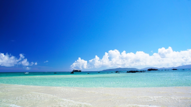
The coastal area of Belize includes the largest barrier reef in the Northern Hemisphere, offshore atolls, several hundred sand cays, mangrove forests, coastal lagoons, and estuaries. It is one of the most biodiverse ecosystems in the Atlantic and is home to colorful fish and playful sea turtles, many of which are endangered.
Robert Griffin, a professor at the University of Alabama in Huntsville, was working on a NASA project to study the reef’s health when COVID-19 happened. “The pandemic created a natural experiment,” Griffin said, to better understand how urban pollutants affect water quality and coral reef health.
Griffin and his team are studying how decreased tourism is impacting urban and agricultural sources of pollutants, such as nitrogen and phosphorus, to water quality off the coast of Belize.
In addition to on-the-ground data, the team is using Landsat images to note how the pandemic is affecting land use changes, which affects how many pollutants are produced and able to reach water bodies and ecosystems. Griffin is also using MODIS and VIIRS data to monitor water quality.
Griffin’s team is working with Belize government officials to help guide coastal marine development for the upcoming five years. “This research could provide guidance for land use planners as they determine how to deal with urban non-point sources of pollution,” like nutrients and sediments, that end up in the water and impact coral reef systems, Griffin said.
Dust storms, society, and COVID-19
Pablo Méndez-Lázaro, a professor at the University of Puerto Rico in San Juan, is examining how the environment could affect the spread of the novel coronavirus that causes COVID-19. More specifically, he wants to know if seasonal African dust that travels to the Caribbean between May and August every year will have significant impacts on health and mortality associated with the virus.
African dust travels from the Sahara Desert, across the Atlantic Ocean, to Puerto Rico and the Caribbean. Microorganisms in the dust particles can be linked to infectious diseases.
Méndez-Lázaro and his team are working with epidemiologists, among many specialists, to better understand how African dust impacts public health. “We see this as a Rubik’s Cube,” Méndez-Lázaro said, to demonstrate how his research is one of various moving parts to understand a larger issue. “Each tiny, colored cube is a different part of the puzzle,” focused on epidemiological research, societal studies, clinical studies, vaccine research, and environmental work, Méndez-Lázaro said.
The team is using VIIRS to measure aerosols in the atmosphere as a proxy for the dust clouds that arrive in the Caribbean. It’s also using MODIS and the European Commission’s Copernicus Atmosphere Monitoring System to characterize the aerosols.
Méndez-Lázaro is working closely with the Puerto Rico Department of Health, the National Weather Service’s San Juan Office, as well as physicians and patients, to gather information on people who have contracted respiratory diseases through contact with African dust.
“We believe that there could be an exacerbation of COVID-19 patients in the Caribbean during African dust events,” Méndez-Lázaro said, like the “Godzilla” event in June.
Weather, air quality, and COVID-19
Yulia R. Gel, a professor at the University of Texas at Dallas, and Huikyo Lee, a scientist at NASA’s Jet Propulsion Laboratory in Pasadena, California, along with other collaborators, want to help clarify what environmental factors could impact a second wave of COVID-19 cases and determine how certain we can be with those conclusions.
Her interdisciplinary team is studying whether surface air temperature and humidity are impacting transmission rates, and, if they are, how they are doing it. It’s also teasing out a potential link between aerosols and COVID-19 severity and mortality.
Gel and her collaborators are using weather data from the Atmospheric InfraRed Sounder on the Aqua satellite and Cross-track Infrared Sounder on the Suomi NPP satellite. The team will obtain aerosol data from the Multi-angle Imaging SpectroRadiometer and MODIS and use machine learning algorithms and advanced analyses to track the dynamics of the virus’s spread and its mortality rate over space and time.
More specifically, her team is using geometric deep learning algorithms, coupled with topological data analysis, which allow it to track COVID-19 transmission patterns that are driven, for instance, by different population characteristics, like age, gender, ethnicity, and income, as well as environmental factors. The advanced tools allow the team to consider factors that are not accessible using conventional approaches based on geographic proximity.
Gel aims to provide a powerful software tool to help predict the seasonal COVID-19 progression on a regional to global scale, while quantifying a broad range of associated uncertainties.
For more information, visit https://science.nasa.gov/earth-science/rrnes-awards
■COVID-19パンデミックの間、世界中の科学者が自宅に閉じこもっている間、地球観測衛星は軌道を周回し続け、パンデミックと環境の間のつながりを明らかにする画像を送り返している。”衛星は常にデータを収集しており、私たちがどこかに出かける必要はありません」と、カレッジパークにあるメリーランド大学の助教ハンナ・カーナーは言った。
このプロジェクトは、COVID-19のロックダウン対策が環境にどのような影響を与えているか、環境がウイルスの拡散にどのように影響を与えるかを調査する研究者を支援するものである。
最新のプロジェクト・グループには、COVID-19のロックダウン対策が食糧安全保障、火災生態学、都市の地表熱、雲と温暖化、大気汚染と降水量、水質と水生生態系にどのような影響を与えているかを明らかにするために衛星画像を利用している6つのプロジェクトが含まれています。2つのプロジェクトでは、粉塵や天候を監視することで、環境がウイルスの広がり方にどのような影響を与えているかを探っている。
NASAの地球科学部門はこれらのプロジェクトを管理しており、COVID-19パンデミックの地域から地球規模の環境、経済、社会への影響をよりよく理解するために、地球観測データを利用する新しい方法を発見しています。
COVID期間中の作物のカウント
今年はパンデミックとそれに伴うロックダウン政策が起こるまで、作物にとっては比較的平年並みの年になると思われていました。空路と地上の移動が減少したことで、エタノールの需要が急落し、トウモロコシの価格が下落しました。ロックダウン政策はまた、米国農務省(USDA)の職員が農場に出向き、作物の植え付け、進捗状況、状況に関する情報を収集することを困難にしました。
その後の農作物に関する公的な情報の欠如は、成長期が進むにつれて、農業市場と価格の不確実性と変動を引き起こしました。”市場は、特定の種類の作物がどのくらいの量になるのかを知りたがっています」とカーナー氏は言います。
カーナー氏と彼女のチームは、NASAと米国地質調査所のランドサット、ESA(欧州宇宙機関)のコペルニクスセンチネル2、テラ衛星とアクア衛星に搭載されたNASAの中分解能画像分光放射計(MODIS)、プラネット衛星からの衛星データを利用して、米国農務省の情報を補完しようとしています。
“私たちは衛星データと機械学習を使って、どこでどの作物が生育しているかをマッピングしています」と、カーナー氏は言います。具体的には、米国ではトウモロコシと大豆、ロシアでは冬小麦という主要なコモディティ作物を監視しています」とカーナー氏は述べています。
ロックダウン中の火災の開始と停止
この春、南東部では生物多様性を向上させ、燃料負荷を減らすための意図的な火災ははるかに少なくなっています。
COVID-19のロックダウンが発効したため、米国森林局は3月に南東部の連邦地での全ての意図的な、または規定のある火事を一時的に停止し、ミシシッピ、サウスカロライナ、ノースカロライナの各州機関もこれに続いた。
メリーランド州グリーンベルトにあるNASAゴダード宇宙飛行センターの研究員であるベン・プールター氏は、NASAとNOAAのスオミNPP衛星の可視赤外画像放射計スイート(VIIRS)とMODISのデータを使用して、全国の火災を追跡し、連邦政府の旅行制限のようなCOVID-19の社会的遠距離政策が、東海岸での規定の火傷と西海岸での山火事の両方にどのような影響を与えたかをよりよく理解するために使用している。
最終的に彼のチームは、南東部での火災の減少が生物多様性にどのような影響を与えているかをよりよく理解したいと考えている。なぜなら、いくつかの種が繁栄するために火災に依存しており、植生に燃料が蓄積する原因となっているからである。
国の反対側では、COVID-19の政策がどのように消火活動を複雑にしているかを調査している。消防機関がCOVID-19の拡散を最小限に抑えるために、近接した場所に住む消防士の大規模なキャンプを排除するなど、社会的な距離感の取り方を導入していることから、「西部の州では火災と戦うことが難しくなっているかもしれない」とPoulter氏は述べている。
チームはまた、全国の火災の総数が大気化学にどのような影響を与えるかを調べている。大気質科学者と協力して、西部では山火事、東部では所定の火災が発生した場合に、他の汚染物質の中で二酸化炭素総量が全体的に正味で増加するか減少するかを判断する予定である。
車の数が減ると、表面が高温になるかもしれない
カリフォルニア州シリコンバレーにあるNASAエイムズ研究センターの研究員クリストファー・ポッター氏は、サンフランシスコ・ベイエリアでカリフォルニア州のシェルター・イン・プレイス義務化が道路上の車の数を減らし、駐車場や高速道路、大規模な工業ビルの表面が太陽光を吸収して赤外線熱を反射する方法をどのように変化させたかを調べています。
“3月下旬から4月にかけてはどこも交通量がなかった “とポッター氏は言います。
ポッター氏と彼のチームは、駐車場やその他の表面を監視して、パンデミックの期間中に暑くなったり涼しくなったりするかどうかを確認しています。太陽からの可視光が表面に当たると、吸収されて熱として再放射されます。
チームは、ランドサットの衛星熱赤外センサーの明るさ温度と、国際宇宙ステーションにあるNASAのセンサーであるエコストレスの地表温度を使って、ベイエリアの大規模で平坦な都市の特徴を地図化し、その熱熱流束を測定している。彼はまた、データの真実性を確かめるために、現場での測定値を集めています。
ポッターは次のような質問をしています。自動車が巨大な土地に駐車され、集中している場合、表面の反射率と全体的な熱流束は変化するのでしょうか?ピカピカの車の窓でさえ、日光を反射するのに十分な場合がある、とポッター氏は言う。
ポッターと彼のチームは、ベイエリア全体の都市の熱流束がパンデミックの間にどのように変化したのか、そしてその変化がそこに住む何百万人もの人々にとって多かれ少なかれ健康的な環境にどのように貢献したのかを知りたいと考えています。熱流束の潜在的な変化を理解することは、COVID-19がベイエリアの環境フットプリントをどのように変化させたかを示す重要な指標である、とポッター氏は述べています。
飛行機が少なくなり、雲が少なくなると涼しくなるかもしれない
晴れた青空を見上げて、条件がちょうど良いときに、上空を飛んでいる飛行機が白い雲の跡を残しているのを見ることができるかもしれません。
このような雲は、航空機のエンジンの排気や気圧の変化によって発生します。バージニア州ハンプトンにあるNASAのラングレー研究センターの研究者であるウィリアム・スミスとデイブ・デュダは、数十年前からコントレールを研究してきました。”コントレールは、私たちが自分たちで作り出す唯一の雲の一つです」とデュダ氏は言います。その効果は様々で、定量化するのは難しいが、全体的な正味の効果は温暖化である」とDuda氏は言う。
COVID-19の渡航禁止とロックダウン政策に対応して、私たちは飛行機に乗る回数を大幅に減らしています。デュダとスミスは、航空交通密度がどのようにコントレールの形成とその放射強制力に影響を与えるかをよりよく理解するために、この減少を定量化したいと考えています。言い換えれば、飛行機の数が減り、コントレールの数が減れば、大気を冷やすのに役立っているということでしょうか?
研究チームは、確立されたコントレール検出アルゴリズムを使用して、2020年の減速期間における米国本土と北大西洋の航空交通回廊のカバー率を推定し、航空交通が制限されていなかった数年前のベースライン期間と比較しています。また、デュダとスミスはMODISを使用してコントレールの光学特性を測定し、コントレールが太陽光を反射し、その下の地表や大気からのエネルギーをどのように捕捉するかをよりよく理解するために使用しています。
コントレールを形成するには大気が十分に冷たく湿っていなければならないため、冬から春にかけてコントレールが多くなるのが一般的です。”すべてのコントレールが同じというわけではありません」とDuda氏は言います。雲の中に発生しても、大きな影響はありません。”晴れている時に雲がかかっている時が最も大きな影響を与えます」とDuda氏は述べています。
コントレールがどのように、いつ、どのように形成されるかの理解を深めることは、科学者が飛行機を飛ばすための理想的なルートを航空会社に伝えるのに役立つ可能性があります。”航空会社が乱気流を避けるために今やっているように、時折飛行高度やルーティングの調整を行うことで、コントレールとその影響を減らすことができるかもしれない」とスミスは言った。
より少ない大気汚染はより少ない雨を意味するかもしれない
アイオワシティにあるアイオワ大学のガブリエーレ・ヴィラリーニ教授と、同研究所の科学者であるウェイ・チャン氏は、パンデミック時に大気汚染が減少したことと、米国西部の降水量が急激に減少したこととの関連を理解したいと考えている。
大気中の水分は、エアロゾル(塵のような粒子)の周りで凝縮し、雨や雪として地球に降り注ぐ。2020年2月と3月の米国西部での降水量の減少は、パンデミック時のエアロゾルの減少が原因である可能性があり、例年に比べて降水量が50%以下の地域もあります。降水量の減少がエアロゾルの減少とどのように関係しているかを理解することは、水資源管理者にとって貴重なことである。
ビジャリーニ氏は、水蒸気、降水、エアロゾルに関するNASAの衛星データと、水分や気温などの大気条件と大気中で起こる化学的性質やプロセスを組み合わせることができる包括的な気候モデルを利用することを目指している。このモデルは、エアロゾルの減少が、気候システムの自然な変動性とは対照的に、降水量の減少にどの程度の影響を与えているのかを特定するのに役立ちます。
“このプロジェクトは、COVID-19が自然環境にどのような影響を与えているかを理解するのに役立つでしょう」とVillarini氏は述べています。
ベリーズの水質に人間の痕跡を見つける
ベリーズの沿岸地域は、北半球で最大のバリアリーフ、沖合の環礁、数百の砂の湾、マングローブ林、沿岸ラグーン、および河口が含まれています。それは大西洋で最も生物多様性のある生態系の一つであり、その多くは絶滅危惧種であるカラフルな魚や遊び心のあるウミガメ、に家である。
アラバマ大学ハンツビル校のロバート・グリフィン教授は、COVID-19が発生したとき、サンゴ礁の健康状態を研究するためにNASAのプロジェクトに取り組んでいました。”都市の汚染物質が水質やサンゴ礁の健康にどのような影響を与えるのかをよりよく理解するために、パンデミックは自然な実験台となりました」とグリフィン氏は言います。
グリフィンと彼のチームは、減少した観光客がどのように影響を与えているかを研究しているベリーズの海岸沖の水質に、そのような窒素やリンなどの汚染物質の都市と農業のソース、。
地上データに加えて、チームは、パンデミックがどのように多くの汚染物質が生産され、水域や生態系に到達することができますどのように影響を与える土地利用の変化に影響を与えていることに注意するためにランドサット画像を使用しています。グリフィン氏はまた、MODISとVIIRSのデータを使って水質を監視しています。
グリフィンのチームは、今後5年間の沿岸海洋開発の指針となるよう、ベリーズ政府関係者と協力しています。”Griffin氏は、「この研究は、栄養素や土砂のように、水中に堆積してサンゴ礁システムに影響を与える都市部の非点汚染源にどのように対処するかを決定する際に、土地利用計画者に指針を与える可能性があります」と述べています。
砂塵嵐、社会、COVID-19
サンファンにあるプエルトリコ大学のパブロ・メンデス=ラサロ教授は、COVID-19の原因となる新型コロナウイルスの蔓延に環境がどのように影響を与えうるかを研究している。具体的には、毎年5月から8月にかけてカリブ海に飛来する季節的なアフリカの塵が、ウイルスに関連した健康や死亡率に大きな影響を与えるかどうかを知りたいという。
アフリカの粉塵は、サハラ砂漠から大西洋を横断してプエルトリコやカリブ海に移動する。塵埃の粒子に含まれる微生物は、感染症に関連している可能性がある。
メンデス=ラサロ氏と彼のチームは、アフリカの粉塵が公衆衛生にどのような影響を与えるかをよりよく理解するために、多くの専門家の中でも特に疫学者と協力している。”私たちはこれをルービックキューブのように見ています」と、メンデス=ラサロ氏は、自分の研究がいかに大きな問題を理解するための様々な可動部分の一つであるかを示すために述べています。”疫学研究、社会研究、臨床研究、ワクチン研究、環境研究に焦点を当てて、「小さな色のついた立方体は、それぞれパズルの異なる部分です」と、Méndez-Lázaro氏は述べた。
チームはVIIRSを使用して、カリブ海に到着する塵雲の代理として大気中のエアロゾルを測定しています。また、MODISと欧州委員会のコペルニクス大気モニタリングシステムを使用してエアロゾルの特徴を調べている。
メンデス=ラサロ氏は、プエルトリコ保健省、国立気象局のサンファン事務所、医師や患者と密接に協力して、アフリカの粉塵との接触によって呼吸器疾患に感染した人々の情報を収集している。
“我々は、アフリカの粉塵イベントの間にカリブ海地域でCOVID-19患者の悪化がある可能性があると考えている “と、6月の “ゴジラ “イベントのように、Méndez-Lázaro氏は述べています。
天候、大気の質、COVID-19
テキサス大学ダラス校のユリア・R・ゲル教授とカリフォルニア州パサデナにあるNASAのジェット推進研究所のヒュイキョ・リー科学者は、他の共同研究者と共に、COVID-19の第二波に影響を与えうる環境要因を明らかにし、その結論をどの程度確かなものにすることができるのかを明らかにしたいと考えている。
彼女の学際的なチームは、地表の気温と湿度が感染率に影響を与えているかどうか、もし影響を与えているとすれば、どのように影響を与えているかを研究している。また、エアロゾルとCOVID-19の重症度と死亡率との間に潜在的な関連性を探っている。
Gel氏と彼女の共同研究者は、Aqua衛星に搭載された大気赤外線サウンダーとSuomi NPP衛星に搭載されたクロストラック赤外線サウンダーからの気象データを使用しています。チームは、マルチアングルイメージング分光放射計とMODISからエアロゾルデータを取得し、機械学習アルゴリズムと高度な解析を用いて、ウイルスの拡散とその死亡率のダイナミクスを時空間にわたって追跡する。
具体的には、彼女のチームは幾何学的なディープラーニングアルゴリズムとトポロジカルなデータ解析を組み合わせて、例えば年齢、性別、民族、所得などの異なる人口特性や環境要因によって引き起こされるCOVID-19の感染パターンを追跡することを可能にしています。この高度なツールにより、チームは地理的近接性に基づく従来のアプローチではアクセスできなかった要因を考慮することができる。
Gelは、季節的なCOVID-19の進行を地域から地球規模で予測するための強力なソフトウェアツールを提供することを目指しており、関連する不確実性を幅広く定量化しています。
詳細については、https://science.nasa.gov/earth-science/rrnes-awards をご覧ください。
引用:https://www.nasa.gov/feature/esd/2020/new-projects-explore-connections-between-environment-and-covid-19


コメント